 vesseltracker.com
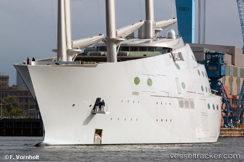
Vessel SY A IMO: 1012141, MMSI: 667002036 Sailing
UTC, 45.65892, 13.72785, course: 106, speed: 0.1
UTC, 45.65857, 13.72802, course: 64, speed: 0.1
2026-03-05 10:12:58 UTC, 45.65840, 13.72810, course: -1, speed: 0.1
Live Vessel SY A Analytics (details, animations, etc.)
Live AIS position: UTC. Near Trieste), updated 2026-03-05 10:12:58 UTC.Find the position of the vessel SY A on the map. The latter are known coordinates and path.
marine traffic ship tracker show on live map
The current position of vessel SY A is 45.65840 lat / 13.72810 lng. Updated: 2026-03-05 10:12:58 UTCCurrently sailing under the flag of Sierra Leone
Details:
Last coordinates of the vessel:
UTC, 45.66000, 13.72833, course: -1, speed: 0UTC, 45.65892, 13.72785, course: 106, speed: 0.1
UTC, 45.65857, 13.72802, course: 64, speed: 0.1
2026-03-05 10:12:58 UTC, 45.65840, 13.72810, course: -1, speed: 0.1