 vesseltracker.com
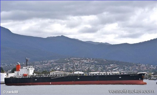
Vessel GATEWAY IMO: 9536832, MMSI: 419002038 Oil Products Tanker
UTC, 13.86864, 121.56157, course: -1, speed: 0.3
UTC, 13.86864, 121.56157, course: -1, speed: 0.3
2026-03-05 06:22:06 UTC, 13.86864, 121.56157, course: -1, speed: 0.3
Live Vessel GATEWAY Analytics (details, animations, etc.)
Live AIS position: UTC. Near Castañas), updated 2026-03-05 06:22:06 UTC.Find the position of the vessel GATEWAY on the map. The latter are known coordinates and path.
marine traffic ship tracker show on live map
The current position of vessel GATEWAY is 13.86864 lat / 121.56157 lng. Updated: 2026-03-05 06:22:06 UTCCurrently sailing under the flag of India
Details:
Last coordinates of the vessel:
UTC, 13.85089, 121.56908, course: -1, speed: 0.1UTC, 13.86864, 121.56157, course: -1, speed: 0.3
UTC, 13.86864, 121.56157, course: -1, speed: 0.3
2026-03-05 06:22:06 UTC, 13.86864, 121.56157, course: -1, speed: 0.3