 vesseltracker.com
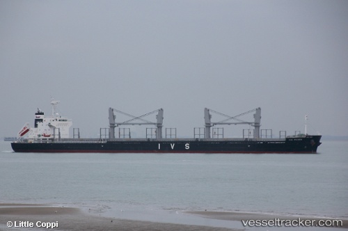
Vessel NORD PHINDA IMO: 9700940, MMSI: 538012366 Cargo
UTC, 49.27988, -4.71882, course: 241, speed: 10.7
UTC, 49.13500, -5.10667, course: -1, speed: 8
2026-03-05 22:01:52 UTC, 48.99333, -5.51667, course: -1, speed: 8
Live Vessel NORD PHINDA Analytics (details, animations, etc.)
Live AIS position: UTC. 20 nm N of Ile D’Ouessant), updated 2026-03-05 22:01:52 UTC.Find the position of the vessel NORD PHINDA on the map. The latter are known coordinates and path.
marine traffic ship tracker show on live map
The current position of vessel NORD PHINDA is 48.99333 lat / -5.51667 lng. Updated: 2026-03-05 22:01:52 UTCCurrently sailing under the flag of Marshall Islands
Details:
Last coordinates of the vessel:
UTC, 49.50667, -4.16167, course: -1, speed: 11UTC, 49.27988, -4.71882, course: 241, speed: 10.7
UTC, 49.13500, -5.10667, course: -1, speed: 8
2026-03-05 22:01:52 UTC, 48.99333, -5.51667, course: -1, speed: 8