 vesseltracker.com
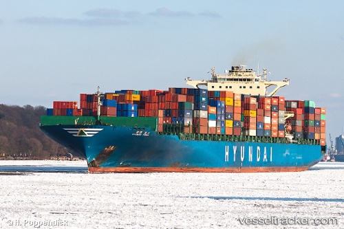
Vessel Hyundai Force IMO: 9347566, MMSI: 538007481 Container Ship
UTC, -26.41800, 44.63773, course: 249, speed: 12.6
UTC, -26.63573, 44.14185, course: 241, speed: 14.5
2026-03-05 10:20:31 UTC, -26.91848, 43.53668, course: 242, speed: 13.9
Live Vessel Hyundai Force Analytics (details, animations, etc.)
Live AIS position: UTC. 143 nm SW of Tsiombe), updated 2026-03-05 10:20:31 UTC.Find the position of the vessel Hyundai Force on the map. The latter are known coordinates and path.
marine traffic ship tracker show on live map
The current position of vessel Hyundai Force is -26.91848 lat / 43.53668 lng. Updated: 2026-03-05 10:20:31 UTCDetails:
Last coordinates of the vessel:
UTC, -26.31942, 44.87300, course: 250, speed: 11.5UTC, -26.41800, 44.63773, course: 249, speed: 12.6
UTC, -26.63573, 44.14185, course: 241, speed: 14.5
2026-03-05 10:20:31 UTC, -26.91848, 43.53668, course: 242, speed: 13.9