 vesseltracker.com
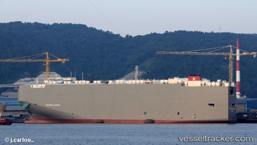
Vessel Hyperion Highway IMO: 9690559, MMSI: 311000322 Vehicles Carrier
UTC, 30.63505, 123.58527, course: 204, speed: 12.8
UTC, 30.41651, 123.48650, course: 230, speed: 11.8
2026-03-05 21:50:35 UTC, 30.32776, 123.03537, course: 289, speed: 10.5
Live Vessel Hyperion Highway Analytics (details, animations, etc.)
Live AIS position: UTC. 36 nm SE of Lü-hua Shan), updated 2026-03-05 21:50:35 UTC.Find the position of the vessel Hyperion Highway on the map. The latter are known coordinates and path.
marine traffic ship tracker show on live map
The current position of vessel Hyperion Highway is 30.32776 lat / 123.03537 lng. Updated: 2026-03-05 21:50:35 UTCDetails:
Last coordinates of the vessel:
UTC, 30.84033, 123.75012, course: 68, speed: 1UTC, 30.63505, 123.58527, course: 204, speed: 12.8
UTC, 30.41651, 123.48650, course: 230, speed: 11.8
2026-03-05 21:50:35 UTC, 30.32776, 123.03537, course: 289, speed: 10.5