 vesseltracker.com
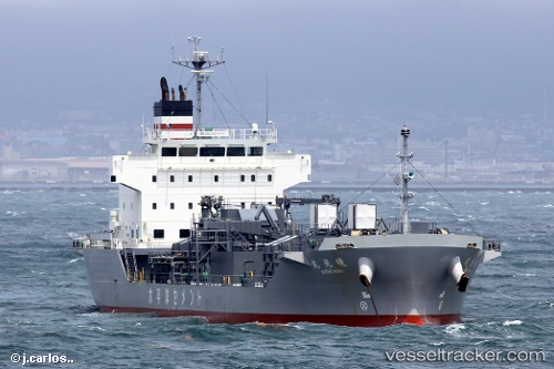
Vessel Gyoko Maru IMO: 9713325, MMSI: 431005927 Cement Carrier
UTC, 35.14079, 138.69324, course: 330, speed: 2.4
UTC, 35.14079, 138.69324, course: 330, speed: 2.4
2026-03-04 22:29:04 UTC, 35.14079, 138.69324, course: 330, speed: 2.4
Live Vessel Gyoko Maru Analytics (details, animations, etc.)
Live AIS position: UTC. Near Fujinomiya, Shizuoka), updated 2026-03-04 22:29:04 UTC.Find the position of the vessel Gyoko Maru on the map. The latter are known coordinates and path.
marine traffic ship tracker show on live map
The current position of vessel Gyoko Maru is 35.14079 lat / 138.69324 lng. Updated: 2026-03-04 22:29:04 UTCCurrently sailing under the flag of Japan
Details:
Last coordinates of the vessel:
UTC, 35.04144, 138.65012, course: 31, speed: 9.4UTC, 35.14079, 138.69324, course: 330, speed: 2.4
UTC, 35.14079, 138.69324, course: 330, speed: 2.4
2026-03-04 22:29:04 UTC, 35.14079, 138.69324, course: 330, speed: 2.4