 vesseltracker.com
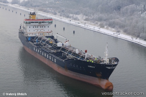
Vessel GUNES K IMO: 9479553, MMSI: 249672000 Oil/Chemical Tanker
UTC, 23.75824, 59.19929, course: 121, speed: 11.6
UTC, 23.56391, 59.53590, course: 119, speed: 11.9
2026-03-06 03:39:34 UTC, 23.28800, 59.90709, course: 151, speed: 12.5
Live Vessel GUNES K Analytics (details, animations, etc.)
Live AIS position: UTC. 46 nm NE of Qalhat), updated 2026-03-06 03:39:34 UTC.Find the position of the vessel GUNES K on the map. The latter are known coordinates and path.
marine traffic ship tracker show on live map
The current position of vessel GUNES K is 23.28800 lat / 59.90709 lng. Updated: 2026-03-06 03:39:34 UTCCurrently sailing under the flag of Malta
Details:
Last coordinates of the vessel:
UTC, 23.91836, 58.91851, course: 122, speed: 11.5UTC, 23.75824, 59.19929, course: 121, speed: 11.6
UTC, 23.56391, 59.53590, course: 119, speed: 11.9
2026-03-06 03:39:34 UTC, 23.28800, 59.90709, course: 151, speed: 12.5